|
|
|
|
|
|
|
|
|
Wednesday, July 11, 2018, we did something that we've never done before, as we took a hike from the "high" country of Yosemite National Park into Yosemite Valley. Sure, we've hiked trails in Yosemite for the past 50+ years, but we've never done a hike like this before. Today's target: Snow Creek Trail.
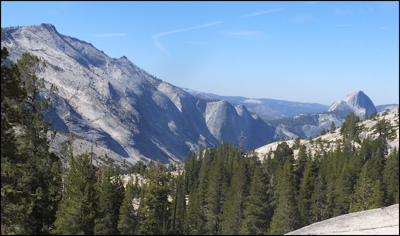
Photo: Classic view of Cloud's Rest and Half Dome, as photographed from Olmsted Point, along the Tioga Road. From Olmsted Point, there is a trail that joins the Snow Creek Trail, but it requires an additional two miles of easy hiking, so we elected to begin our hike from the trailhead, about a half mile east of May Lake.
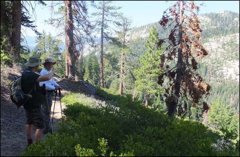
Photo: There are many ways to access Yosemite Valley from the Tioga Road, and the most popular routes are from Porcupine Flat, Olmsted Point, May Lake, or from the route we chose, which starts at a small parking lot on the Tioga Road, about a half mile east of the turn off to May Lake. The elevation at the start of our hike was about 8500 feet, and during the course of our hike, we lost over half of our elevation, as we hit the 4500 foot-level when we arrived in Yosemite Valley, at Tenaya Creek, a mile or so east of Mirror Lake. Greg, Michael and I take a breather, to admire the amazing scenery, about two miles into our hike.
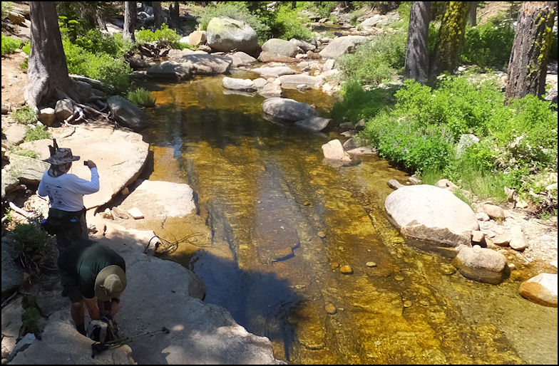
Photo: After about four easy miles of downhill hiking, over easy terrain, you reach Snow Creek, which is about the halfway point of the hike to the valley floor. Fill your canteens at Snow Creek, as water is dubious, at best, until you reach Tenaya Creek, nearly three miles distant, and nearly 3000 feet lower. When we reached the bridge across Snow Creek, we stopped for lunch, and since we'd hiked nearly four miles and - supposedly - half of today's hike, we laughed and joked about what an easy hike this would be. Little did we know what lay ahead of us... Yes, from the bridge across Snow Creek it's all downhill into Yosemite Valley, but it's not just a "walk in the park..." as the "fun" really starts - or ends if you're hiking uphill - shortly after you cross Snow Creek.
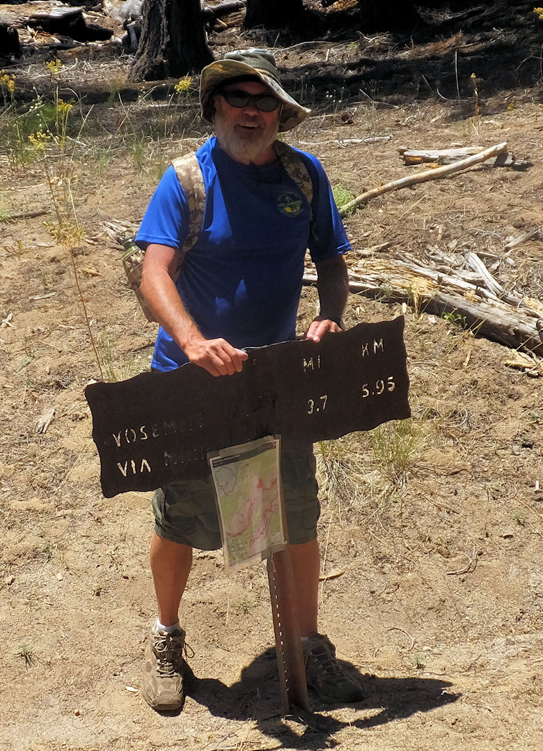
Photo: I post at the major trail junction where the trail forks, and you have your choice between heading uphill to Porcupine Flat, or downhill into Yosemite Valley. Michael's wife, Margi, kindly dropped us off at the trailhead, and we planned to meet her at Half Dome Village - formally known as Camp Curry - so for us, the hike was downhill all the way. However, the downhill hike didn't prove to be a "walk in the park," so to say... If you like solitude, this is a good hike, as we only saw two back-country rangers, who were working near the Snow Creek crossing, and one solitary backpacker, who was hiking from May Lake to Yosemite Valley.
Photo: About a quarter mile after crossing Snow Creek, we took a little diversion off the trail to take a few photos, including this photo of Cloud's Rest. The views are absolutely beyond description, and the photos can't even convey the sheer beauty! God's beauty in the finest!
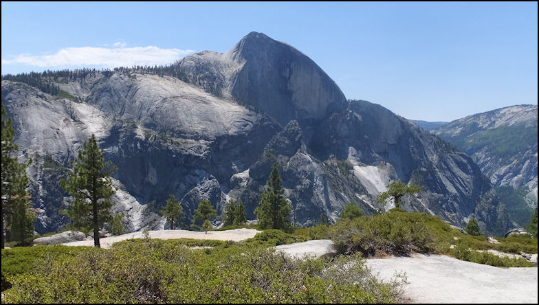
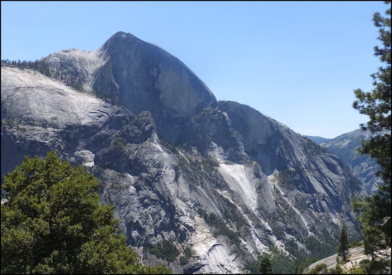
Photo: Famous Half Dome from a very different angle. From our view - about 5 miles from the crow fly - you could actually make out people climbing the back of that famous rock. Greg brought along a pair of small binoculars which made the climbers look like ants ascending the steep slope. As a side note, it's 8 miles each way, plus a 4800 foot elevation gain if you want to climb Half Dome from Yosemite Valley at Happy Isles. I've done the hike twice, once with a two-night stay in "Little Yosemite Valley," and once - when I was in my early 20's - as a "day hike." What a BRUTE of a "day hike" as you gain 4800 feet of elevation and the round trip is over 16 miles! As of 2008, you can only climb Half Dome if you have a reservation, such is the popularity of Yosemite National Park, and the climb to Half Dome. Not our worries on this early July afternoon, as we were able to get a good view of Half Dome from the Snow Creek Trail.
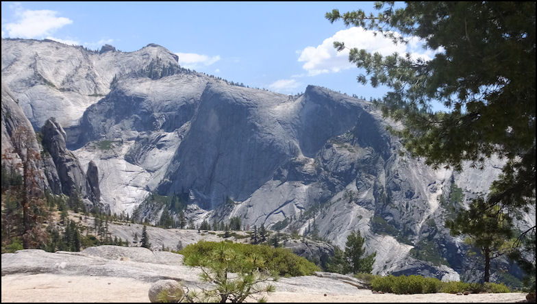
Photo: Looking down into Yosemite Valley, about a quarter mile after crossing Snow Creek, and taking a 200-yard sidetrack from the trail. You really don't want to venture further to get that "great shot" as the granite begins to slope drastically, and it has decomposed rocks on it's slope. Think "ball bearings" and you have a nearly vertical 3000 foot drop to Tenaya Canyon. Not the sort of "ride" that I'd like to take.
Photo: Basket Dome, as viewed from our vantage point, above Snow Creek crossing, and before we began the long descent into Yosemite Valley.
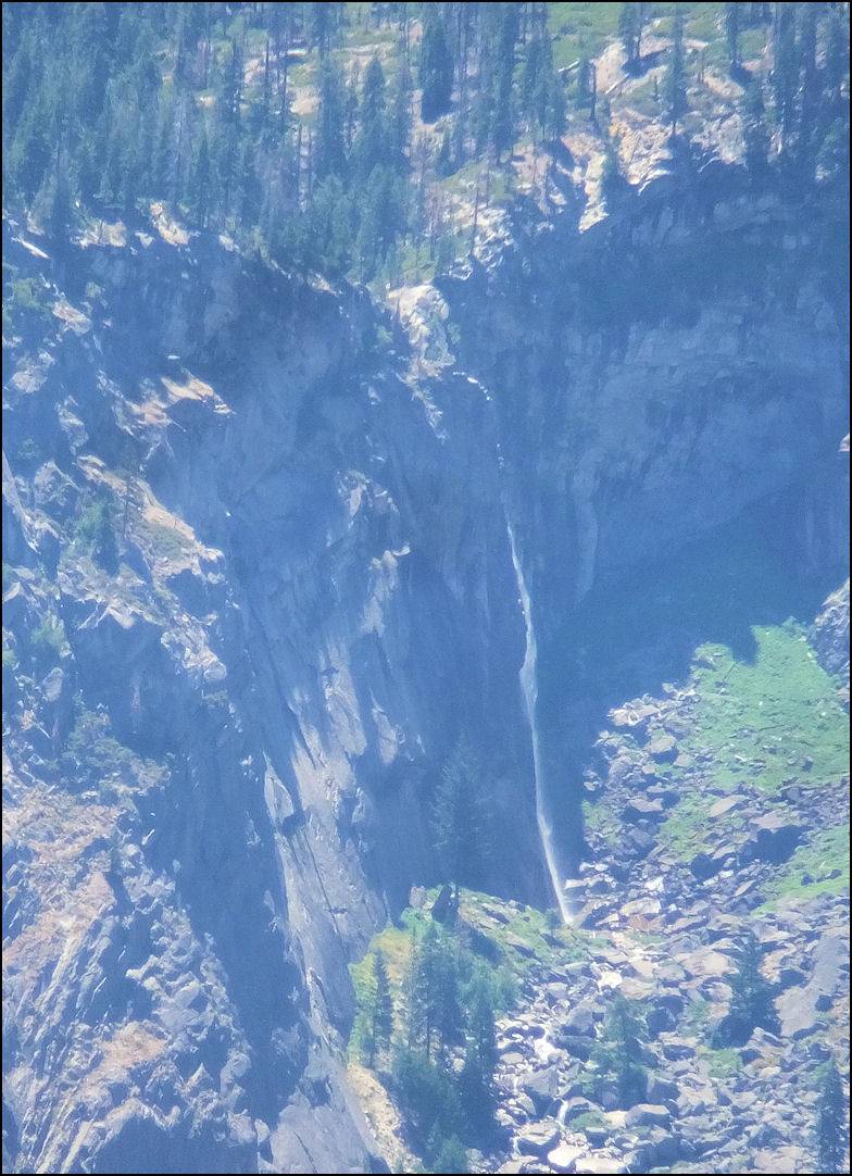
Photo: On this early July day, Illilouette Falls was still running, with plenty of force. Yes, this is a full telephoto shot from the trail, but the view is worth a million dollars.
Photo: Another view of Half Dome, the kind of view that you won't see unless you hike the Snow Creek Trail. Yosemite National Park draws millions of visitors each year, but except for one hike and two backcountry rangers at work, we had the 8+ mile trail to ourselves.
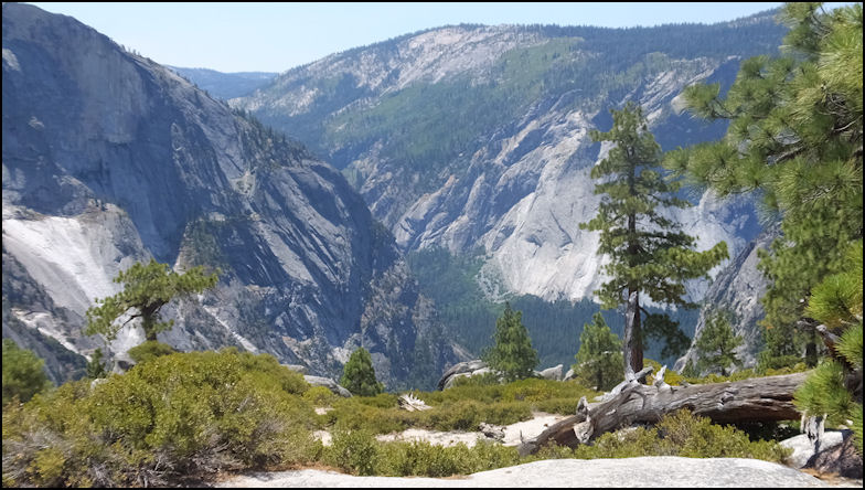
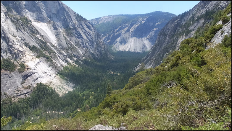
Photo: View of Yosemite Valley and lower Tenaya Canyon, as seen from Snow Creek Trail, about a half mile west after crossing the bridge over the creek. It's at this point that the real "fun" begins, as you descent around 3000 feet in less than two miles. It's not a "walk in the park," so to speak, although it's all downhill, it's not easy, as there are uneven stair steps, uneven rocks, boulder, decomposed granite, and all sorts of things that could hurt you. Even though you're in the mountains, it's hot as the 4th of July, as there is very little shade, and between the exposed sun, and the granite, you feel like you're baking in an oven. Fill your canteen at Snow Creek, as there is very little water on the trail - if any - until you reach Tenaya Creek. If you're hiking uphill, fill your canteen at Tenaya Creek and be prepared to drink lots or water on the crazy-steep hike uphill to Snow Creek. Good luck! I can't even imagine slogging up this beast of a trail, especially during July. They say there are a hundred switchbacks, but it seems like it's more than a thousand of them. Hiking this trail uphill, especially backpacking, this would be total torture. The lack of water would only add to the misery.
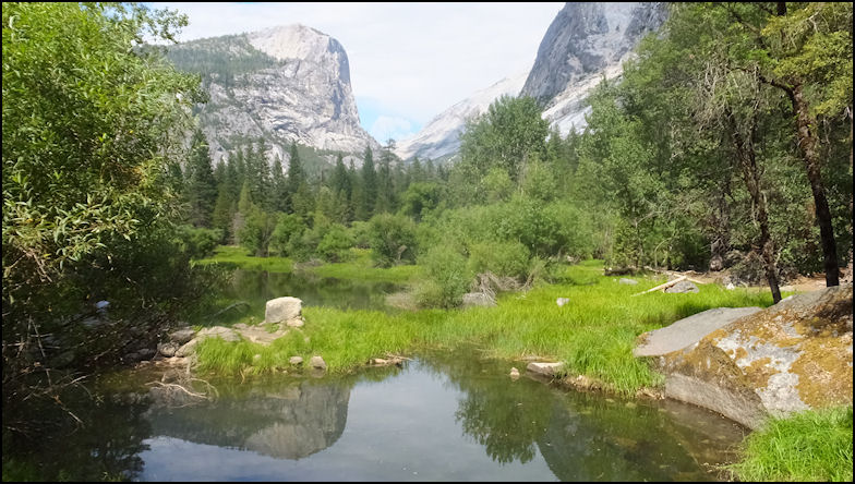
Photo: Mirror Lake, with Mt. Watkins reflected in the lake, or to be precise, what's left of it. The Park Service has been labeling this as "Mirror Meadow" in the past several years, and that's a pretty good description, as the lake is pretty much gone and the meadow has taken over.
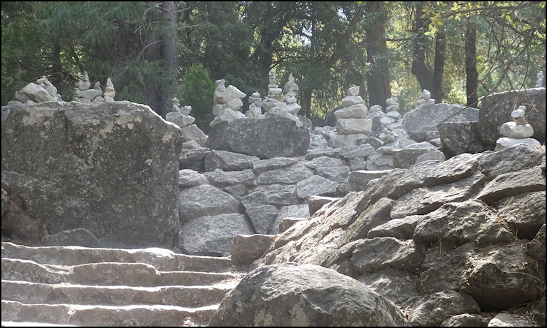
Photo: Near the west end of Mirror Lake, we found a "Stone Henge" of rock cairns, ducks, markers, or whatever you want to call them. Apparently these have been in place for many years and have been crafted by many individuals over the years. Call it "natural graffiti?" We wonder why the Park Service permits this, when nearly all other activities are forbidden.
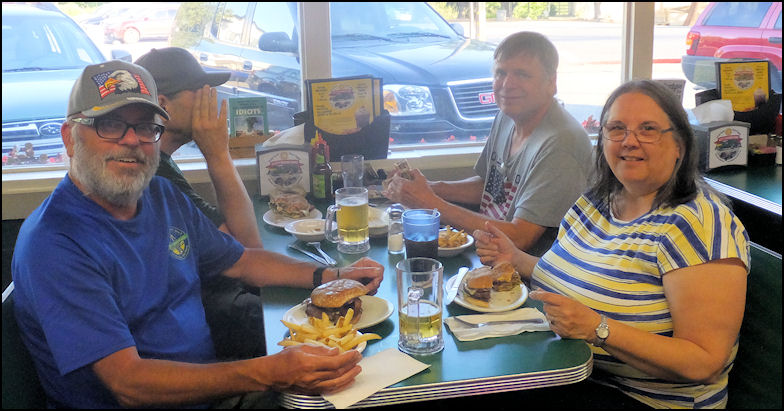
Photo: The trail ended at Happy Burger in Mariposa, where we enjoyed a dinner of beer, burgers and fries. Click on the link to read all about our fine dinner. The sign from the parking lot on the Tioga Road says it's 8.7 miles to Yosemite Valley, but I'm not sure where or how they measure it, as my GPS read a tad over 11 miles from the trail head to the shuttle bus stop near Mirror Lake. No worries, as no matter what you do, or whatever happens, it's always a good day when you take a hike in Yosemite National Park. Copyright(c) 2018 eRench Productions. All rights reserved. We've been on the web since December 22, 2002.
|